Governor John White's Map 1585-1593
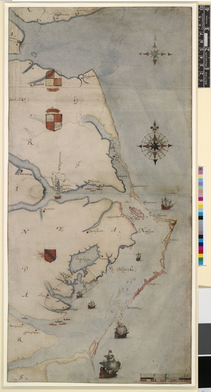
"La Virginea Pars", map of the E coast of N America from Chesapeake bay to Cape Lookout; with royal arms and compass, English vessels, Indian canoes and villages. Drawing by John White.
Retrieved from http://www.britishmuseum.org/research/collection_online/collection_object_details.aspx?objectId=753203&partId=1
Current Map of the East Coast
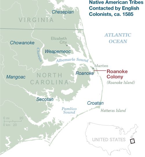
Retrieved from: http://news.nationalgeographic.com/news/2013/12/131208-roanoke-lost-colony-discovery-history-raleigh/
